Boundaries in context
Bellevue has varying boundaries for the neighborhoods when you look at alternate maps, so please ensure you’re looking at the relevant map for your purposes!
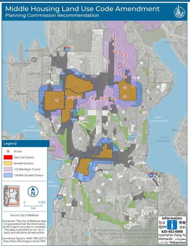
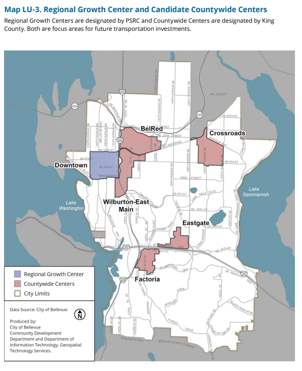
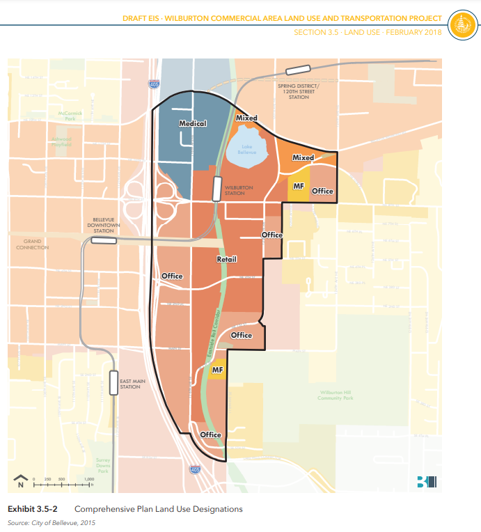
The Middle Housing LUCA map (above) is based on the LU-3 map from the Comprehensive Plan (below). Downtown is a PSRC regional growth center, and BelRed, Crossroads, Wilburton-East Main, Factoria, and Eastgate are countywide growth centers (King County). It’s important to note that other maps of Bellevue have other definitions for these areas, as shown below. In particular, compare the boundaries of BelRed and Wilburton.
Other maps
ArcGIS Bellevue Map Viewer
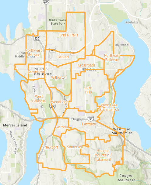
Neighborhood Boundaries, can zoom and apply overlays. This map is used to determine who your Neighborhood Liaison is. There was a previous version with fewer neighborhoods.
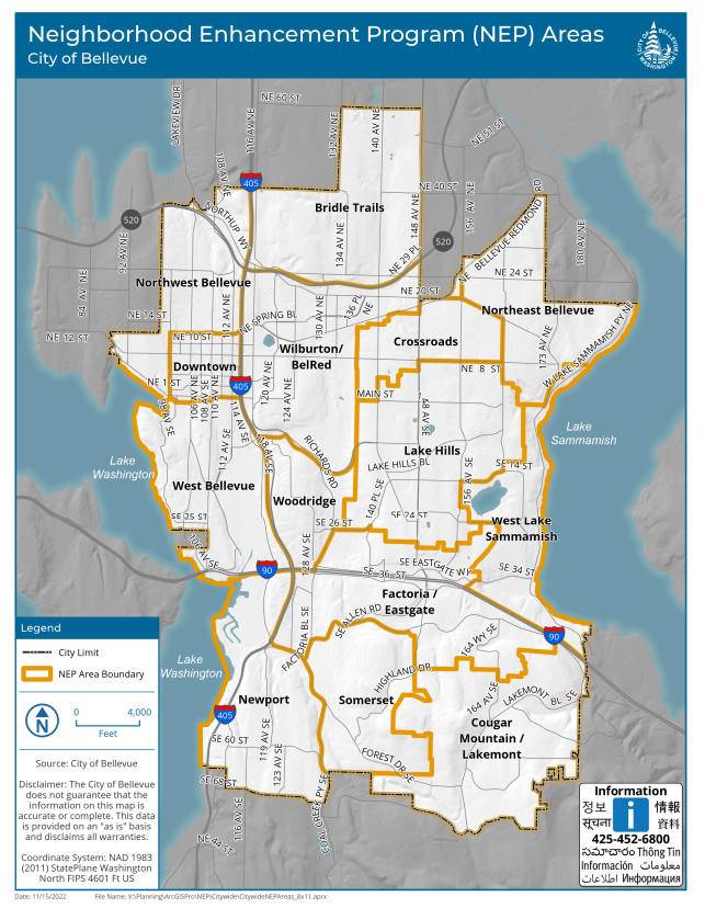
Neighborhood Enhancement Program
Dated 2022, but I think this is still the version that applies. Northwest Bellevue and Bridle Trails are having the NEP program this year, and it will rotate.
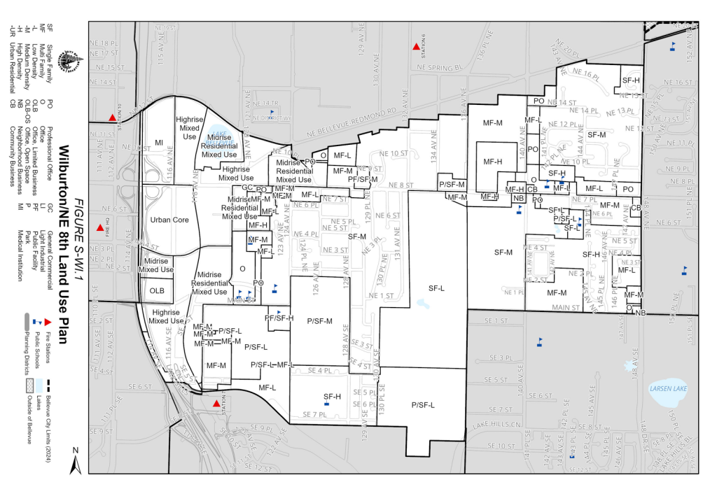
Wilburton
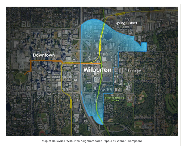
Weber Thompson map
This is recent, and probably based on a city map. I’m pretty sure I’ve seen versions with other boundaries defined in the edge along Bel Red Road.
Spring District and Overlake Village
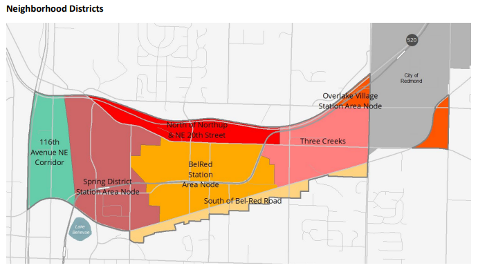
Spring District Station Area Node
The area in mauve is associated with the Spring District, according to this map from the Belred Subarea Plan draft in June 2024.
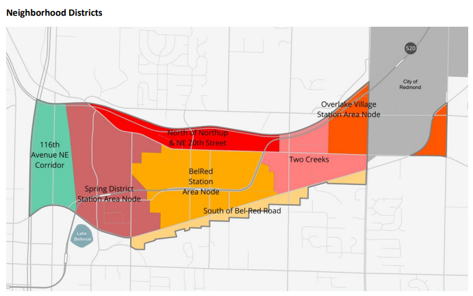
Overlake Village Station Area Node
In this Belred Subarea Plan (final) map, from later in 2024, Three Creeks has become Two Creeks and the Overlake Village Station Area Node is expanded
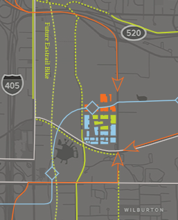
Wright Runstad map
This map from the official Spring District website includes just the building footprints shown.